GIS Data Layers
The following data layers are available for download. Shapefiles are distributed as ZIP archives and include the underlying data table, but requires a GIS application such as QGIS to read. Click on the thumbnails for larger preview images of each layer.
Layers
- Global
- Regional
Global
Global data is provided in unprojected form (latitude/longitude, WGS84/EPSG:4326).
| Data Set | Description | Style | Last update | Formats |
|---|---|---|---|---|
| GNIS Classes | A table of the feature classes and definitions used by the United States Geological Survey's Geographic Names Information System (GNIS) database. | Table | 2017-02-18 | |
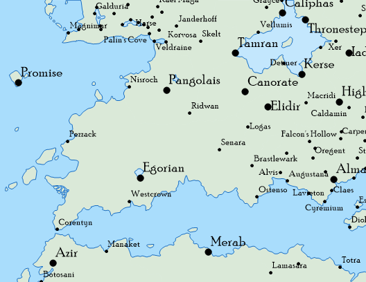
Golarion Cities
|
Capitals, cities and towns in Golarion where the location can be determined. Includes population for some cities. | Point | 2018-08-26 | Shapefile KML |
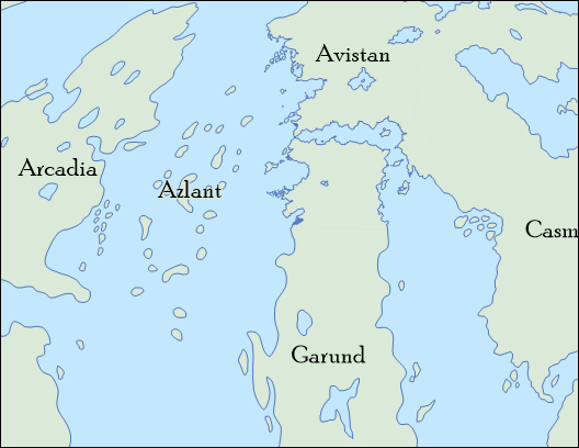
Golarion Continents
|
Golarion's continents, now officially canon thanks to the Pathfinder 2E core rule book. | Polygon | 2019-11-20 | Shapefile, KML |
Golarion Points of Interest
|
Points of interest across Golarion with GNIS classifications. Features are mapped to GNIS classes to produce the "best fit" but some decisions are arbitrary (e.g., active monasteries and temples are mapped to churches, but temple ruins are mapped to locales). See the GNIS Classes layer. The POI table includes a "HasMarker" field which indicates whether or not the feature has a marker on the Inner Sea Poster Map in addition to the label. |
Point | 2017-09-02 | |
| Water Body Feature Codes | A table of water body feature codes. This is a subset of the codes used by the United States Geological Survey's National Hydrography Dataset. | Table | 2017-03-07 | CSV, DBF |
| Water Line Feature Codes | A table of water line feature codes. This is a subset of the codes used by the United States Geological Survey's National Hydrography Dataset. | Table | 2017-03-07 | CSV, DBF |
Crown of the World
The Crown of the World data comes from the Jade Regent Poster Map Folio.
Shapefiles are provided in both unprojected (latitude/longitude, WGS84/EPSG:4326) and projected form (custom coordinate system based on Azimuthal_Equidistant). The projected format should only be used if you know what you are doing, and why you need it. Splitting projected data across the 180 degree longitude line is not a trivial task. Only use the projected shapefile if you are building a north-pole view of the Crown of the World, or a similarly regional map.
| Data Set | Description | Style | Last update | Formats |
|---|---|---|---|---|
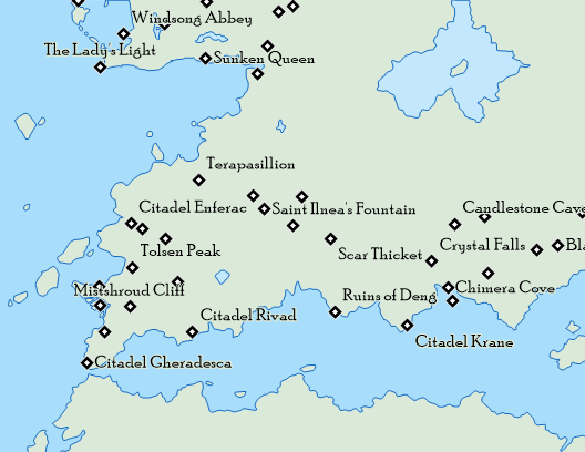
Crown Forests
|
Forested regions with names where known. | Polygon | 2017-03-09 | Shapefile, Shapefile (projected), KML |
Crown Regions
|
The Crown of the World does not have countries with formal political borders. While it does have regions, their boundaries are not defined. As a result, this region layer really only contains the land mass for the Crown as a whole. | Polygon | 2017-03-09 | Shapefile, Shapefile (projected), KML |
Crown Rivers
|
Rivers at the Crown of the World with names where known. | Line | 2017-03-09 | Shapefile, Shapefile (projected), KML |
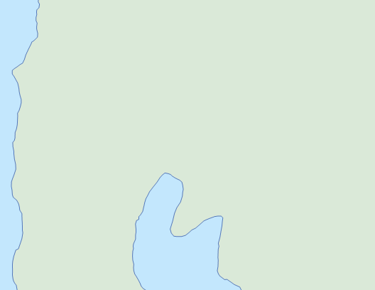
Crown Water Bodies
|
Major water features at the Crown of the World, including the ice shelf, with names where known. | Polygon | 2017-03-09 | Shapefile, Shapefile (projected), KML |
Darklands
The Darklands layers come from the Pathfinder Chronicles supplement Into the Darklands for 3.5/OGL. When this was first published, the exact positions of the Darklands entrances were not precisely placed in the Inner Sea. When the Inner Sea World Guide came along a few years later, the corresponding points of interest received exact placements and all of them shifted from the rough positions given on the Into the Darklands maps. Some POIs, such as the Earthnavel, moved hundreds of miles. These changes forced adjustments to the Darklands data in order to properly line up with the Inner Sea map data. Some of these changes are minor, and some are significant.
Darklands data is provided in unprojected form (latitude/longitude, WGS84/EPSG:4326).
| Data Set | Description | Style | Last update | Formats |
|---|---|---|---|---|
Major Darkland Entrances
|
Major Darkland entrances, taken from Into the Darklands. Entrance locations have been adjusted to match those in the Inner Sea World Guide. Major entrances coincide with their corresponding Inner Sea POI and City layer, and with the Nar-Vorth Ascents and Descents layer. | Point | 2017-02-26 | Shapefile, KML |
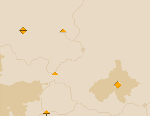
Nar-Voth Ascents and Descents
|
Nar-Voth ascents and descents. Ascents are coincident with major Darkland entrances. The Shapefile data table includes a Direction field:
|
Point | 2017-02-26 | Shapefile, KML |
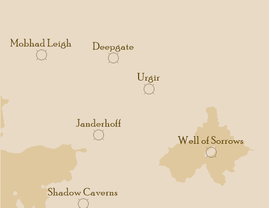
Nar-Voth Points of Interest
|
Nar-Voth points of interst with GNIS classifications. | Point | 2017-02-26 | Shapefile, KML |
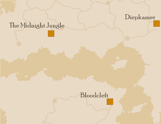
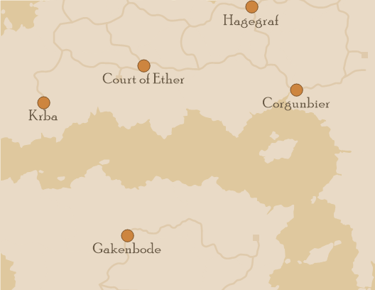
Nar-Voth Settlements
|
Major humanoid settlements in Nar-Voth with populations. | Point | 2017-02-26 | Shapefile, KML |
Nar-Voth Tunnels
|
Primary and secondary tunnels in Nar-Voth. Some significant adjustments had to be made to accomodate changes to the Darkland entrance locations and corresponding settlements and POIs. | Line | 2017-02-26 | Shapefile, KML |
| Orv Ascents | Ascent points from Orv into Sekamina. | Point | 2017-03-26 | Shapefile, KML |
| Orv Rivers | Underground rivers in Orv | Line | 2017-03-26 | Shapefile, KML |
| Orv Tunnels | Primary and secondary tunnels in Orv. | Line | 2017-03-26 | Shapefile, KML |
| Orv Vaults | The vaults. | Polygon | 2017-03-26 | Shapefile, KML |
| Orv Water Bodies | Underground lakes and the Sightless Sea. | Polygon | 2017-03-26 | Shapefile, KML |
| Sekamina Ascents and Descents | Sekamina ascents to Nar-Voth and descents into Orv. Note that these locations are not necessarily coincident with points on other layers. Ascents and descents are not assumed to be perfectly vertical. The Shapefile data table includes a Direction field:
|
Point | 2017-03-26 | Shapefile, KML |
| Sekamina Points of Interst | Sekamina points of interst with GNIS classifications. | Point | 2017-03-26 | Shapefile, KML |
| Sekamina Rivers | Underground rivers in Sekamina. | Line | 2017-03-26 | Shapefile, KML |
| Sekamina Settlements | Major humanoid settlements in Sekamina with populations. | Point | 2017-03-26 | Shapefile, KML |
| Sekamina Tunnels | Primary and secondary tunnels in Sekamina. | Line | 2017-03-26 | Shapefile, KML |
| Sekamina Water Bodies | Underground water bodies in Sekamina. | Polygon | 2017-03-26 | Shapefile, KML |
Inner Sea
Inner Sea data is provided in unprojected form (latitude/longitude, WGS84/EPSG:4326).
| Data Set | Description | Style | Last update | Formats |
|---|---|---|---|---|
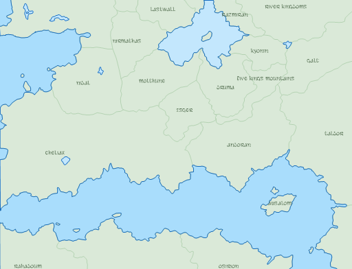
Inner Sea Countries
|
Countries in Avistan and Garund that make up the Inner Sea poster map, plus all of Qadira from the Qadira, Jewel of the East supplement. | Polygon | 2017-02-08 | Shapefile, KML |
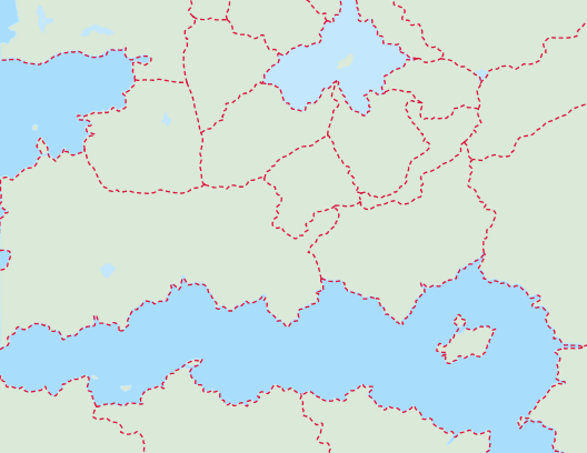
Inner Sea Country Boundaries
|
A cartographic layer showing the political boundaries of countries in the Inner Sea. This is essentially the dotted red lines that appear on the map in the Inner Sea World Guide. | Line | 2017-02-02 | Shapefile, KML |
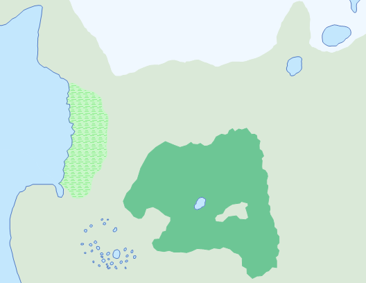
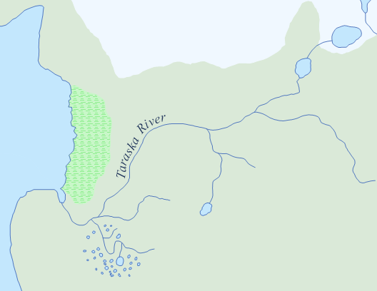
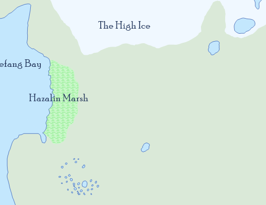
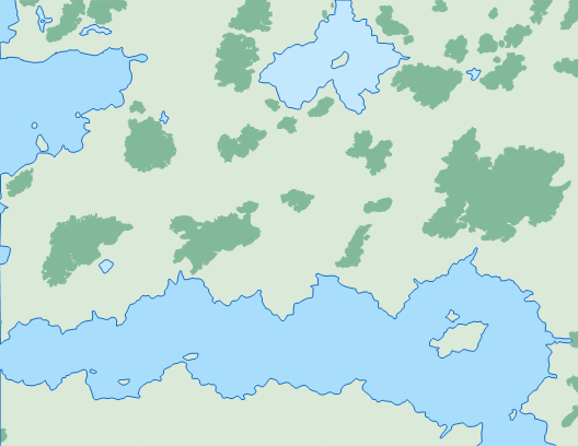
Inner Sea Forests
|
Forest boundaries across the Inner Sea. These were roughly traced around forested areas shown on the Inner Sea World Guide map. Layer provided by Paizo forum user Garrett Guillotte. |
Polygon | 2017-09-02 | |
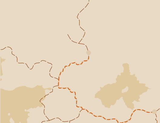
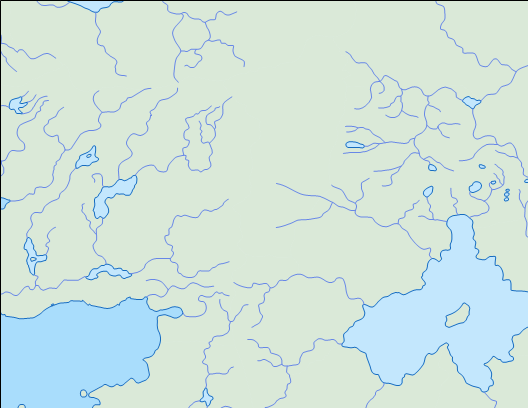
Inner Sea Rivers
|
River centerlines for the Inner Sea region with river names where known. Base source is the Inner Sea poster map, with supplemental sources for: Andoran, Cheliax, Lands of the Linnorm Kings and Ustalav. Lines are oriented in the direction of water flow. |
Line | 2017-09-02 | |
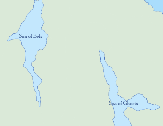
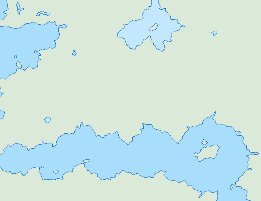
Inner Sea Water Bodies
|
The oceans and large lakes in the Inner Sea region with names where known. Base source is the Inner Sea poster map, with supplemental sources for: Andoran, Cheliax, Lands of the Linnorm Kings and Ustalav. | Polygon | 2017-09-02 | Shapefile, KML |
Tian Xia
Shapefiles for Tian Xia are provided in both unprojected (latitude/longitude, WGS84/EPSG:4326) and projected form (custom coordinate system based on Azimuthal_Equidistant). The projected format should only be used if you know what you are doing, and why you need it. Splitting projected data across the 180 degree longitude line is not a trivial task. Only use the projected shapefile if you are building a regional Tian Xia map.
| Data Set | Description | Style | Last update | Formats |
|---|---|---|---|---|
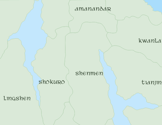
Tian Xia Countries
|
Countries, empires and regions in Tian Xia that make up the Tian Xia map from the Dragon Empires Gazetteer supplement. The Wall of Heaven region has been extended up to where it meets with the Crown of the World map, and a non-canonical feature was added to allow shorelines from the two Paizo maps to "meet". |
Polygon | 2017-02-23 | Shapefile, Shapefile (projected), KML |
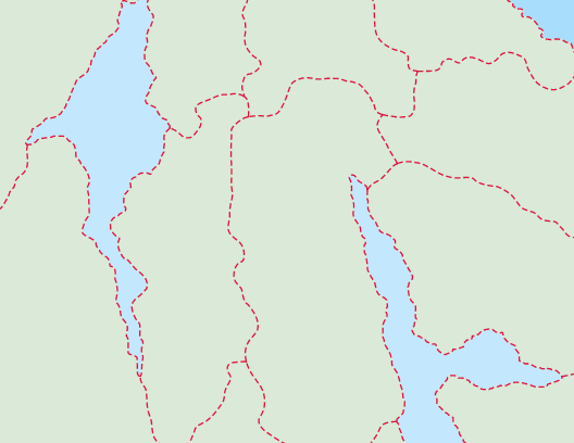
Tian Xia Country Boundaries
|
A cartographic layer showing the political boundaries of Tian Xia. These are the dotted lines that appear on the map in the Dragon Empires Gazetteer. |
Line | 2017-02-23 | Shapefile, Shapefile (projected), KML |
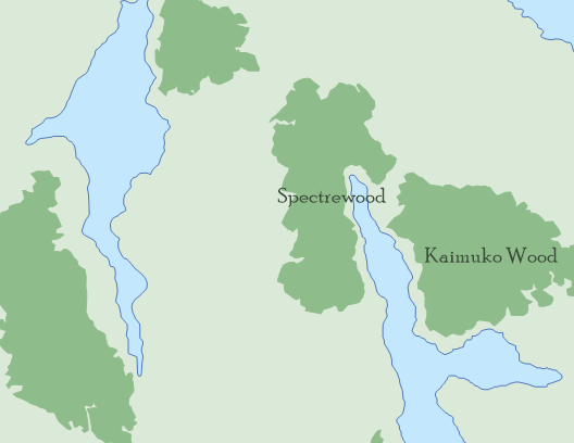
Tian Xia Forests
|
Forests areas in Tian Xia. These were roughly traced around forested areas shown on the Dragon Empires Gazetteer map. Layer provided by Paizo forum user Garrett Guillotte. |
Polygon | 2017-03-11 | Shapefile, Shapefile (projected), KML |
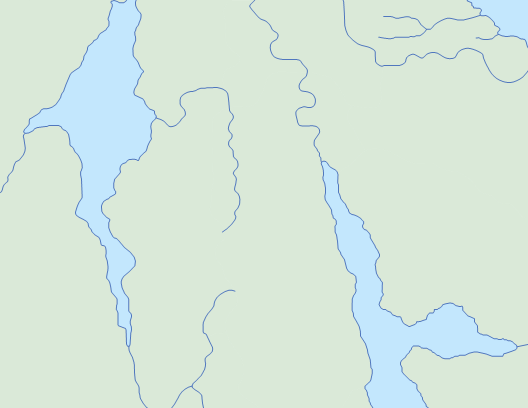
Tian Xia Rivers
|
River centerlines for Tian Xia with river names where known. Lines are oriented in the direction of water flow. |
Line | 2018-08-26 | Shapefile, Shapefile (projected), KML |
Tian Xia Water Bodies
|
Oceans, inland seas, and large lakes from the Tian Xia region with names where known. There is a sliver cut out on the northern edge where the continents layer meets the countries layer. |
Polygon | 2018-08-26 | Shapefile, Shapefile (projected), KML |